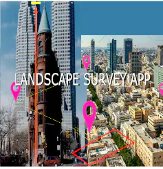
Landscape Surveying App
App for computing areas and height of objects
Landscape Surveying App launched on March 30, 2020 with 2 votes. The site was still online in September 2026, 6 years on.
What it does
Landscape built-environment experts may need to quantify the areas encompassing all the visible features of an area of land; not only that what of height of objects? It is important to have handy tools that can help to compute a few basic parameters.
Does a similar job
all alternatives → Measure Tool in Google Earth2018 · earth.google.com · ▲110
Measuring distance and area in Google Earth

- G3Global 3D topography explorer2025 · topography.jessekv.com · ▲118
I made a web app to generate 3D models of real places on earth from land cover and elevation data. Click anywhere on the map to get a polygon, and then click "generate". It should work at most scales, but if your watershed or region selection is too large, the result can be less exciting because it's so flat. As a warning, the 3D models can sometimes be too much for my phone. It's nicer on desktop. I'm still working better on mobile support. The land cover data I'm using gives a cool effect, but at some point I'd like to add in global imagery and clouds. The backend is a Python thread…



More work this month
the category →
 Smooth Recorder▲257
Mac screen recordings that look edited when you hit stop
Work · 24d ago · smoothrecorder.com


Work · 18d ago · readrare.com
Source: Product Hunt launch ↗
Launched alongside, March 2020
the whole month →

 Fraidycat▲807
Life & fun · 2020 · fraidyc.at
 MainStreet▲540
Founders: You're owed $50K. Get it back in 20 minutes 🤝
Commerce · 2020 · mainstreet.com

108 free flat illustrations with customizable characters
Dev tools · 2020 · patterns.page
- TF
Life & fun · 2020 · bingetogether.com