Alternatives
Products that do what Fieldr studio does
Turn spreadsheets into interactive territories
- 1

- 2

- 3
- 4

- 5

- 6

- 7
- 8

- 9

- 10DF
Creating data visualizations with AI nowadays often means chat, chat and more chats...and writing long prompts can be annoying while they are also not the most effective way to describe your visualization designs. Data Formulator blends UI interaction with natural language so that you can create visualizations with AI much more effectively! You can: * create rich visualizations beyond initial datasets, where AI helps transforming and visualizing data along the way * iterate your designs and dive deeper using data threads, a new way to manage your conversation with AI. Here is a demo video:…
2024 · github.com
- 11
- 12AS
Hi all! A little background: I've been working on natto.dev, a spatial environment for JavaScript. I'm really excited about new interfaces for code (leveraging metaphors we're good at, spatial reasoning, making state visible, design tools, etc). With all the buzz around PyScript, I discovered Pyodide and got it working inside natto. This Python version is a stripped down version of https://natto.dev (eg interactive outputs, multiplayer) so please check that out if this interests you. I'm excited to share this spatial environment for Python. Imagine Jupyter cells arranged on a 2D…
2022 · python.natto.dev
- 13

- 14

- 15

- 16LW
Hi HN, I made a web game to practice country locations a while ago and HN liked it, so I thought I'd post my updated version as well. As for how the game works and feels, I'd really recommend you checking it out for yourself, it's free, no signup, no ads. The tech stack is Vue + ts + Tailwind/Daisy for the looks. The learning algorithm is a slight modification of the ts version of FSRS. If you have anything to add, it's open source as well (https://github.com/koljapluemer/learn-worldmap), although not well documented yet. In the end it's just a little sideproject,…
2025 · map.koljapluemer.com
- 17

- 18IM
Technologies used: Leaflet (frontend) Turf (Geojson generation and Voronoi generation) I noticed that my neighborhood is all Lawsons, so I got the location of all Conbinis and ran some basic analysis to see if these pockets of brand territory are common. I haven't worked much with web frontends before, so feedback is welcomed. I also have some ideas to maybe expand upon, like making the territory calculations based on streets and other geographical features rather than just beeline distance. The site isn't tested too much on mobile yet, but should be ok. Currently the frontend code and…
2024 · conbini.kikkia.dev
- 19

- 20

- 21

- 22IM
Hi HN, I built a little tool to help me get better at remembering country locations on the map: https://learn-worldmap.netlify.app/ It's made from plain HTML/CSS/JS, and not intended to make any money or anything. Just thought that maybe someone else may enjoy it. Also of course happy about any feedback! Cheerz.
2023 · learn-worldmap.netlify.app
- 23

- 24SD
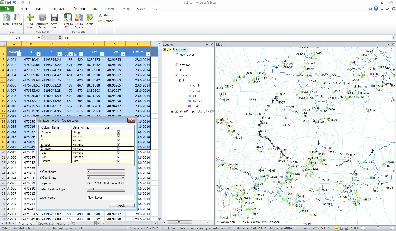
2016 · gisxl.com
Ranked by how close each launch is in meaning, then by votes. Refine with a description →