Dev tools · alternatives · 2026
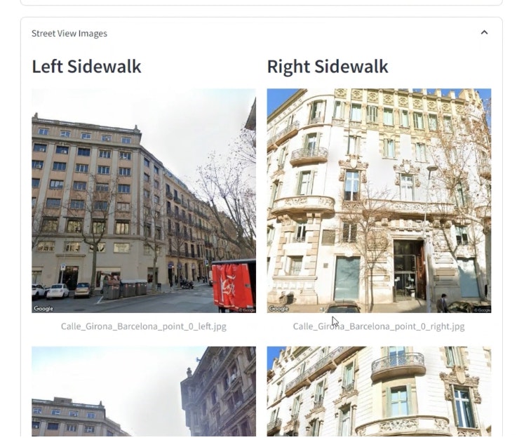
24 alternatives to Street View Analyzer
#Python #Streamlit #Geocode #GoogleStreetView #GPT4o #OpenAI
Below are 24 products that do a similar job, ranked by how close each is in meaning and then by launch-day votes. Street View Analyzer launched in 2024; newer entries below may have overtaken it.
- 1

Instantly see a Google Street View of any supported location. Easily share and save your favourite views.
2012 · qsview.com · its alternatives →
- 2
 DataMonkey▲676
Your GeoAI to combine in-house with public map-based data
2024 · datamonkey.tech · its alternatives →
- 3

I was developing/selling this application under Roadometry, but sales are getting slow and I'd prefer to make it available for free. This is a desktop Windows application which can be used for counting road traffic. https://roadometry.com https://www.youtube.com/@roadometry2011 The application uses Multiple Hypothesis Tracking (MHT) combined with Darknet Yolo. I trained the network myself. I have a tool-chain for building a video-based training set including associations, but it's quite complex to use. I never ended up training a network to perform association,…
2024 · github.com · its alternatives →
- 4

Pathfinding visualizer on a real map, anywhere in the world
2024 · honzaap.github.io · its alternatives →
- 5SV
2020 · callumprentice.github.io · its alternatives →
- 6
 City Roads▲227
Open source, visualization of all roads within any city.
2020 · github.com · its alternatives →
- 7

The quickest and easiest territory mapping software that you ever used. Trusted by more than 1000 customers for data-driven decisions
2018 · oalley.net · its alternatives →
- 8
 Footpath▲194
Plan exact travel routes with the trace of your finger 🗺️
2018 · footpathapp.com · its alternatives →
- 9
 Road Count▲145
Monitor and record traffic on your street with AI
2022 · roadcount.com · its alternatives →
- 10DS
2016 · christophercliff.com · its alternatives →
- 11

- 12

I am a member of HackCville, a collective of UVA students and Charlottesville community members who are passionate about entrepreneurship, technology, and ge...
2017 · byu.io · its alternatives →
- 13

Hey HN, jvaclavik here from OpenClimbing team! We are thrilled to release version 2.0 of our fully opensource/opendata climbing guide. Based on OpenStreetMap for map-data and Wikimedia Commons for images, we created a (hopefully) user-friendly app which completely uses these open databases, thus contributing data back to commons. We designed a simple and powerful notation for drawing climbing routes directly over the Wikimedia pictures: - https://wiki.openstreetmap.org/wiki/Key:wikimedia_commons:pa... Check out the release article for a ton of new features, or go…
2014 · openstreetmap.org · its alternatives →
- 14

Hey HN, I made a site where you can draw on street-level panoramas. Your drawings persist and other people can see them in real time. Strokes get projected onto the 3D panorama so they wrap around buildings and follow the geometry, not just a flat overlay. Uses WebGL2 for rendering, Mapillary for the street imagery. The idea is for it to become a global canvas, anyone can leave a mark anywhere and others stumble onto it.
Mar 2026 · washere.live · its alternatives →
- 15

Real-time Geospatial and Geofencing. Contribute to tidwall/tile38 development by creating an account on GitHub.
2019 · github.com · its alternatives →
- 16

Hey everyone, I've made this website that I hope can help some people. The original inspiration comes from being tired of having a specific site (and finding it!!) that serves my needs for a single purpose. Straight forward tools, no fuss. The objective is to be fully in-browser, no login and if possible without contacting a remote server. PGP Key Analyser - Analyze PGP keys directly in your browser - finally I can see the infos without having to download the key on my device Proton Date - Check ProtonMail account creation dates - pretty niche I admit Favicon Hash - Generate website favicon…
2025 · kriztalz.sh · its alternatives →
- 17GI
Visualize your collected Google Location History data using an interactive heatmap directly in your browser.
2014 · theopolisme.github.io · its alternatives →
- 18

OpenSource game with Google Map StreetView
2022 · geoguess.games · its alternatives →
- 19IE
Geolocation AI trained on 50M streetview images
Dec 2025 · view.geospot.sdan.io · its alternatives →
- 20

- 21

Real-time Geospatial and Geofencing. Contribute to tidwall/tile38 development by creating an account on GitHub.
2016 · github.com · its alternatives →
- 22
- 23

A tool that finds out exactly where photos were taken
Mar 2026 · its alternatives →
- 24

Also compare
Ranked by how close each launch is in meaning, then by votes. Prices were read from each product’s own site when checked and can change. Refine with your own description →