Life & fun · alternatives · 2026

24 alternatives to Geoparsing
57.68980,11.97347 geocode.xyz - A geoparser, geocoder and batch geocoder for Sweden. Put your data on a map.
Below are 24 products that do a similar job, ranked by how close each is in meaning and then by launch-day votes. Geoparsing launched in 2019; newer entries below may have overtaken it.
- 1

geocode.xyz - A geoparser, geocoder and batch geocoder for the world. Map your data.
2018 · geocode.xyz · its alternatives →
- 2

- 3

Revolutionize GIS data management with Geoman for Leaflet, MapLibre, and Mapbox. Add drawing, editing, cutting, splitting, snapping, measuring, and more directly on the map.
2020 · geoman.io · its alternatives →
- 4
 Code.xyz▲378
The online code editor for building APIs in a single click.
2018 · namekeeper.com · its alternatives →
- 5

Geocoding and data enrichment for North America that just works
2014 · geocod.io · its alternatives →
- 6IM
Hi HN, I built a little tool to help me get better at remembering country locations on the map: https://learn-worldmap.netlify.app/ It's made from plain HTML/CSS/JS, and not intended to make any money or anything. Just thought that maybe someone else may enjoy it. Also of course happy about any feedback! Cheerz.
2023 · learn-worldmap.netlify.app · its alternatives →
- 7LW
Hi HN, I made a web game to practice country locations a while ago and HN liked it, so I thought I'd post my updated version as well. As for how the game works and feels, I'd really recommend you checking it out for yourself, it's free, no signup, no ads. The tech stack is Vue + ts + Tailwind/Daisy for the looks. The learning algorithm is a slight modification of the ts version of FSRS. If you have anything to add, it's open source as well (https://github.com/koljapluemer/learn-worldmap), although not well documented yet. In the end it's just a little sideproject,…
2025 · map.koljapluemer.com · its alternatives →
- 8

For the uninitiated, a geocoder is maps-tech jargon for a search engine for addresses and points of interest. Geocoders are expensive to run. Like, really expensive. Like, $100+/month per instance expensive unless you go for a budget provider. I've been poking at this problem for about a month now and I think I've come up with something kind of cool. I'm calling it Airmail. Airmail's unique feature is that it can query against a remote index, e.g. on object storage or on a static site somewhere. This, along with low memory requirements mean it's about 10x cheaper to run an Airmail…
2024 · blog.ellenhp.me · its alternatives →
- 9

- 10

Flexible tool to build planet-scale vector tilesets from OpenStreetMap data fast - onthegomap/planetiler
2021 · github.com · its alternatives →
- 11

- 12

A free collection of maps for every country in the world, available in 11 sizes or in SVG. - djaiss/mapsicon
2013 · github.com · its alternatives →
- 13
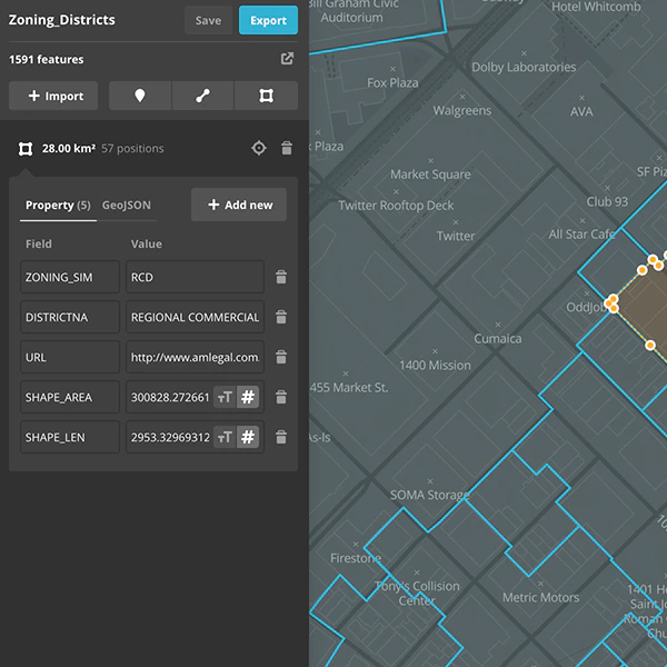
Creating and edit geospatial data in your browser
2016 · mapbox.com · its alternatives →
- 14G3
I made a web app to generate 3D models of real places on earth from land cover and elevation data. Click anywhere on the map to get a polygon, and then click "generate". It should work at most scales, but if your watershed or region selection is too large, the result can be less exciting because it's so flat. As a warning, the 3D models can sometimes be too much for my phone. It's nicer on desktop. I'm still working better on mobile support. The land cover data I'm using gives a cool effect, but at some point I'd like to add in global imagery and clouds. The backend is a Python thread…
2025 · topography.jessekv.com · its alternatives →
- 15M1
2018 · geonames.tile38.com · its alternatives →
- 16AA
2019 · geohash.world · its alternatives →
- 17

An API to convert coordinates to and from places.
2016 · opencagedata.com · its alternatives →
- 18

- 19MD
2023 · louisquissetlabs.com · its alternatives →
- 20
 A5▲95
Pentagonal geospatial indexing system DGGS. Contribute to felixpalmer/a5 development by creating an account on GitHub.
2025 · github.com · its alternatives →
- 21

We built Maptoolkit.org - a free, production-grade vector maps service built on OpenStreetMap and MapLibre. Map rendering and tile hosting have historically been either expensive (Google, Mapbox) or complex to maintain yourself. (Plus: Their maps are car-focused.) Our maps feature max data zoom 15, global hill-shading, 3D terrain, contour lines, water depths, and specialized styles (like Hiking, Cycling, Winter). No sign up or API keys required. You can use it like this: ``` const map = new maplibregl.Map({ container: 'map', style: 'https://styles.maptoolkit.org/summer.json',…
Jul 2026 · maptoolkit.org · its alternatives →
- 22GI
2016 · geoparser.io · its alternatives →
- 23

Free, Easy Map Coordinate Conversions with Batch Processing
2024 · latlongconverter.online · its alternatives →
- 24AO
I've recently been working with real-time geoJSON data at a rate of 50+ queries per second. SaaS solutions can be prohibitively expensive at this rate, thus, I created go-reverse-geo. Data is pulled from geonames.org and is stored in MongoDB (a requirement of my current project). It is very much a work-in-progress (I wrote it this morning). Hope someone finds it useful. https://paranoia.dev/vivi/go-reverse-geo
2020 · its alternatives →
Also compare
- Geoparsing and Sentiment Analysis of text alternatives
- Geocode.XYZ alternatives
- Free GeoJSON editor to visualize, download or convert into many formats alternatives
- Code.xyz alternatives
- Ridiculously cheap bulk geocoding alternatives
- I made a little tool to practice country positions on the world map alternatives
Ranked by how close each launch is in meaning, then by votes. Prices were read from each product’s own site when checked and can change. Refine with your own description →