
Plot modern addresses on Earth 240M years ago
Earth looked very different long ago. Search for addresses across 750 million years of Earth
Plot modern addresses on Earth 240M years ago launched on June 11, 2018 with 384 votes, #24 of 2,653 launches that month and more than 99% of that year's launches. The site was still online in September 2026, 8 years on.
In plain words
This tool maps modern-day addresses to their locations as they existed 240 million years ago during the early Mesozoic era. Users enter a current address and see where that geographic point was positioned on the ancient supercontinent. It appeals to geology enthusiasts, educators, and anyone curious about how Earth's continents have shifted over deep time. The visualization combines current location data with paleogeographic reconstructions to show continental drift in a personal, interactive way.
written from the facts on this page · September 2026
From the sources
This visualization is created and maintained by Ian Webster. See more of my work at ianww.com or email me at [email protected] . Click here to subscribe to occassional email updates when we add something interesting to this visualization such as new dinosaur or plate tectonic data. Plate tectonic and paleogeographic maps by C.R. Scotese, PALEOMAP Project. For more information visit: https://www.earthbyte.org/paleomap-paleoatlas-for-gplates & www.globalgeology.com . Read more about the methods used here . Some elements of this visualization are not adjusted for time (eg. cloud and star positions). The locations are accurate to ~100 km. The coloring of the maps is based on elevation…from dinosaurpictures.org
Does a similar job
all alternatives → Today's cities on a globe of Earth's tectonic past and futureAug 2026 · douwe.com · ▲37
A rotatable Earth that drags today's countries and major cities through the Merdith 2021 plate reconstruction model, plus a simple future extrapolation. Continents keep their color families while the land follows plate motion from 1000 million years ago to 250 million years ahead.
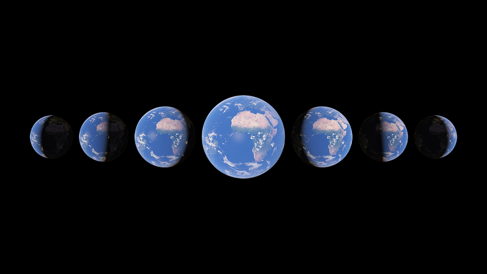 Timelapse in Google Earth2021 · earth.google.com · ▲325
Watch time unfold and witness 40 years of planetary change
 What country you would hit if you went straight where you're pointing2025 · apps.apple.com · ▲80
This app was designed to answer my wife’s question “what country would we hit if we went straight” (generally posed while pointing her phone) But with two additional twists: 1. It loads up historical maps from different years (right now 1 BC, 700 AD, 1000 AD, 1300 AD, 1800 AD, 1900 AD) so you can see what you would hit if you had a time machine AND you went in the direction your phone is pointing 2. Tap a country/territory for an (AI-generated) blurb on what you are pointing at How it works: Starting from your phone’s bearing, we trace the great-circle in 200 km steps, prefilter…
 A map that shows you how far you can go for a given time or distance2018 · oalley.net · ▲455
The quickest and easiest territory mapping software that you ever used. Trusted by more than 1000 customers for data-driven decisions
 Globe of HistoryNov 2025 · globeofhistory.com · ▲189
I built Globe of History — an interactive 3D visualization of 6,000 years of human events, mapped onto the Earth’s surface. It includes 5,000+ data points covering wars, inventions, assassinations, natural disasters, and philosophers — spanning 4000 BCE → 2025 CE. The main goal was to build a visual entry point into history — not a database, but a way to instantly sense density and continuity over time. Stack / Process Python for scraping structured event data from Wikipedia/Wikidata Gemini 2.0 Flash for AI-based enrichment and multi-stage verification Mapbox GL JS + React (Vite)…
 Phersu Atlas2023 · phersu-atlas.com · ▲68
Interactive historical atlas - daily data and 4M statistics
More life & fun this month
the category →
A free city-building game in your browser. You are the mayor. You know what the city needs. Now get it past the zoning board, the neighbors, the appeals court and the next election.
Life & fun · 3d ago · permit.petercai.com
- IV
Life & fun · 15d ago · tanzaniaeducationproject.org

Turn a phone, tablet or TV into a sign. Type a message and it fills the screen: welcome signs, timers, Wi-Fi passwords and more. No app, no account, free.
Life & fun · 16d ago · bigwords.page

Play a free virtual guitar online with your keyboard or by touch. Slow songs down and see every chord, string and strum. Acoustic, classic, electric and bass.
Life & fun · 10d ago · guitoro.com

Carrier settings from iPhone, Pixel and Galaxy firmware, decoded and compared: APNs, VoLTE, 5G and Wi-Fi Calling per carrier, and what each build changed.
Life & fun · 14d ago · carrierexplode.com

Life & fun · 24d ago · space.bl2.net
Source: Show HN post ↗
Launched alongside, June 2018
the whole month →

- OL
Dev tools · 2018 · openlogos.org
 Google Podcasts▲648
Discover and listen to the world's podcasts on Android.
Work · 2018 · play.google.com


This quick quiz helps you understand why you
Life & fun · 2018 · whydoiprocrastinate.com