Growth · alternatives · 2026

24 alternatives to Skies-adsb 2.0 – my 3D plane-tracking web app
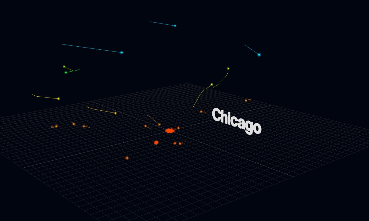
Hello, I'd like to share a 3D plane tracking web app that I developed called: skies-adsb. Living near KMIA (a very busy airport), I spend a lot of time plane spotting and thought it would be cool to track planes in 3D. In October 2021, I built a prototype 3D ADS-B flight tracker called skies-adsb using p5.js. In April 2022, I released version 1.0 of skies-adsb, rewritten in Three.js. However, this release still relied on manual editing of GeoJSON layers. By late 2024, I had learned enough about GIS and GeoPandas to automate map creation using custom GeoJSON layers. During the Christmas…
Skies-adsb is a 3D web application for tracking aircraft in real-time using ADS-B data. Built with Three.js, it displays planes in three-dimensional space above interactive maps. The application is designed for… Below are 24 products that do a similar job, ranked by how close each is in meaning and then by launch-day votes. Prices are shown for the 1 we have checked on their own sites.
- 1IM
Hey HN! Pilots everywhere are required to keep a logbook of all their flying hours, aircraft, airports, and so on. Since I track everything digitally (some people still just use paper logbooks!), I put together some data visualizations and a few 3D globes to show my flying history. This globe is probably my favourite so far: https://jameshard.ing/pilot/globes/all If you’ve got ideas for other graphs or ways to show this kind of data, I’d love to hear them!
2025 · jameshard.ing · its alternatives →
- 2
 ADS-B visualizer▲339
I've created a web app for querying and visualization of ADS-B datasets: https://adsb.exposed/ Source code: https://github.com/ClickHouse/adsb.exposed/ The results significantly exceeded my expectations because the pictures are insanely beautiful, and the data is a treasure trove. It proves many statements that were not certain: - it is feasible to generate tiles by aggregation on a pixel level (instead of hexagons or rectangular grid); - it does not require JPG/PNG tiles - we can transfer raw bitmap data with zstd compression; - it is possible to…
2024 · adsb.exposed · its alternatives →
- 3

I built a real-time flight tracker that renders 10,000+ aircraft on an interactive 3D globe, entirely in the browser using Rust compiled to WebAssembly.
Apr 2026 · flight-viz.com · its alternatives →
- 4
 Flighty 4.0▲296
Live flight tracker w/ the world's fastest delay alerts
2024 · flighty.com · its alternatives →
- 5

A redesigned web experience to find & track flights 🔎✈️🌎
2018 · google.com · its alternatives →
- 6

For HTML Day 2025 [1], I made a web service that displays the current sky at your approximate location as a CSS gradient. Colours are simulated on-demand using atmospheric absorption and scattering coefficients. Updates every minute, without the use of client-side JavaScript. Source code and additional information is available on GitHub: https://github.com/dnlzro/horizon [1] https://html.energy/html-day/2025/index.html
2025 · sky.dlazaro.ca · its alternatives →
- 7

Hi HN! Sharing Random Airport Inspired by RandomStreetView (which I find weirdly addictive), and a passion for air travel. Probably not for everyone, but I hope some of you find it interesting! Needless to say, open to feedback! Enjoy clicking! Further reading: TECH: It's Build in React, NodeJS, with a Notion DB. The code is public on Github. It is spaghetti though ... Especially open to feedback here. DB: The db is publicly available (and editable), I can add the link in comments if anyone would like to have a look . KNOWN ISSUES: I would like to improve the design, pic loading performance…
2023 · randomairport.onrender.com · its alternatives →
- 8
 Flight Follower▲114
Ad free flight tracking for aviation enthusiasts
Jan 2026 · flightfollower.app · its alternatives →
- 9

I've been working on this project for about 4 years. It began as terrain only because world wide elevation data was publicly available. I then added buildings from OpenStreetMap (crowd sourced) and more recently from Overture Maps data. Some computer vision/machine learning advancements [1] in the past few years have made it possible to estimate tree canopy heights using satellite imagery alone making it possible to finally add trees to the map. The data isn't perfect, but it's within +/- 3 meters of so. Good enough to give a general idea for any location on Earth. Happy to answer…
2024 · shademap.app · its alternatives →
- 10
 We built the smallest dual-band aircraft trackerfrom $48/mo▲95
I grew frustrated with closed source ADS-B receivers a few years ago, and wanted to build a true low cost embedded ADS-B receiver from scratch for low power applications. I ended up developing a custom radio frontend that uses RP2040 PIO for Mode S preamble detection and demodulation, and also released the first open soruce implementation of UAT decoding on an RF MCU from TI (which works somewhat beyond the publicly stated specs for the chip). Today, ADSBee is a fully featured dual-band ADS-B receiver, with Mode S, ADSB, UAT ADSB, UAT TIS-B / FIS-B, a ton of configurable reporting…
Aug 2026 · pantsforbirds.com · its alternatives →
- 11
- 12

DIY plane spotting with a Raspberry Pi and an Android phone
2025 · pilane.obviy.us · its alternatives →
- 13

Developer-centric approach to quickly building internal UIs
2022 · its alternatives →
- 14

Sup HN, So I got tired of bouncing between Flightradar, MarineTraffic, and Twitter every time something kicked off globally, so I wrote a dashboard to aggregate it all locally. It’s called Shadowbroker. I’ll admit I leaned way too hard into the "movie hacker" aesthetic for the UI, but the actual pipeline underneath is real. It pulls commercial/military ADS-B, the AIS WebSocket stream (about 25,000+ ships), N2YO satellite telemetry, and GDELT conflict data into a single MapLibre instance. Getting this to run without melting my browser was the hardest part. I'm running this on a laptop…
Mar 2026 · github.com · its alternatives →
- 15

- 16AAAstro App▲291
I really like Stellarium and SkySafari but I felt like these are primarily geared towards exploring the sky but not so much "here are the long list of things I want to see, when can I see them tonight and where". There's also not really a great option I've found that combines sky object planning + location weather details while still being free so I built this. The UI's heavily inspired by NINAs sky atlas + Robinhood. Right now you can: View the altitude chart of objects and 3D view Create lists of objects of interest View the annual max/min daily altitude of an object to find the best…
2024 · astro.sshh.io · its alternatives →
- 17

- 18MN
http://flightlite.com Flightlite is a visual flight tracker combining 3D and overhead views and flight information. It is my first launch since I started reading Hacker News and was developed as a side project for the past 6 months or so. I made the final push on it this morning to get it to a semi-launchable state. - The best coverage is US and UK - Sometimes the data I get is a bit crazy (spent a lot of effort to correct/sanitise it but it's not perfect) - Doesn't work in IE 64bit or Linux due to Google Earth not being available I'm now trying to work out how to take this further, if there…
2010 · flightlite.com · its alternatives →
- 19

- 20

Track the real-time location of any aircraft, all in 3D
2024 · store.steampowered.com · its alternatives →
- 21

- 22

- 23

The original flight tracker, now in 3D, and now with ARKit!
2017 · planefinder.net · its alternatives →
- 24
Also compare
- I'm an airline pilot – I built interactive graphs/globes of my flights alternatives
- ADS-B visualizer alternatives
- Flight-Viz – 10K flights on a 3D globe in 3.5MB of Rust+WASM alternatives
- Flighty 4.0 alternatives
- Google Flights 2.0 alternatives
- The current sky at your approximate location, as a CSS gradient alternatives
Ranked by how close each launch is in meaning, then by votes. Prices were read from each product’s own site when checked and can change. Refine with your own description →