Life & fun · alternatives · 2026

24 alternatives to Open Data
Access free, valuable, regularly updated satellite imagery.
Below are 24 products that do a similar job, ranked by how close each is in meaning and then by launch-day votes. Open Data launched in 2023; newer entries below may have overtaken it.
- 1

SkyFi delivers satellite imagery, radar (SAR), AIS data, and analytics from the world's top providers in one platform. Search, analyze, and download geospatial data in hours.
2023 · app.skyfi.com · its alternatives →
- 2

Browser-Based Satellite Imagery Analysis Platform
Jan 2026 · offnadir-delta.com · its alternatives →
- 3

I've been working on this project for about 4 years. It began as terrain only because world wide elevation data was publicly available. I then added buildings from OpenStreetMap (crowd sourced) and more recently from Overture Maps data. Some computer vision/machine learning advancements [1] in the past few years have made it possible to estimate tree canopy heights using satellite imagery alone making it possible to finally add trees to the map. The data isn't perfect, but it's within +/- 3 meters of so. Good enough to give a general idea for any location on Earth. Happy to answer…
2024 · shademap.app · its alternatives →
- 4OO
Hi HN, After 9 years of running my own OpenStreetMap tile server infra for MapHub (https://news.ycombinator.com/item?id=11389989), I've open-sourced it and launched OpenFreeMap. You can either self-host or use our public instance. Everything is open-source, including the full production setup — there’s no 'open-core' model here. Check out the repo (https://github.com/hyperknot/openfreemap). The map data comes from OpenStreetMap. I also provide weekly full planet downloads both in Btrfs and MBTiles formats. I aim to cover the running costs of the public…
2024 · openfreemap.org · its alternatives →
- 5
A "virtual satellite" to map Earth in unprecedented detail
2025 · deepmind.google · its alternatives →
- 6

- 7

Satellite imagery for dummies. Contribute to plant99/felicette development by creating an account on GitHub.
2020 · github.com · its alternatives →
- 8

- 9AAAstro App▲291
I really like Stellarium and SkySafari but I felt like these are primarily geared towards exploring the sky but not so much "here are the long list of things I want to see, when can I see them tonight and where". There's also not really a great option I've found that combines sky object planning + location weather details while still being free so I built this. The UI's heavily inspired by NINAs sky atlas + Robinhood. Right now you can: View the altitude chart of objects and 3D view Create lists of objects of interest View the annual max/min daily altitude of an object to find the best…
2024 · astro.sshh.io · its alternatives →
- 10

Sup HN, So I got tired of bouncing between Flightradar, MarineTraffic, and Twitter every time something kicked off globally, so I wrote a dashboard to aggregate it all locally. It’s called Shadowbroker. I’ll admit I leaned way too hard into the "movie hacker" aesthetic for the UI, but the actual pipeline underneath is real. It pulls commercial/military ADS-B, the AIS WebSocket stream (about 25,000+ ships), N2YO satellite telemetry, and GDELT conflict data into a single MapLibre instance. Getting this to run without melting my browser was the hardest part. I'm running this on a laptop…
Mar 2026 · github.com · its alternatives →
- 11
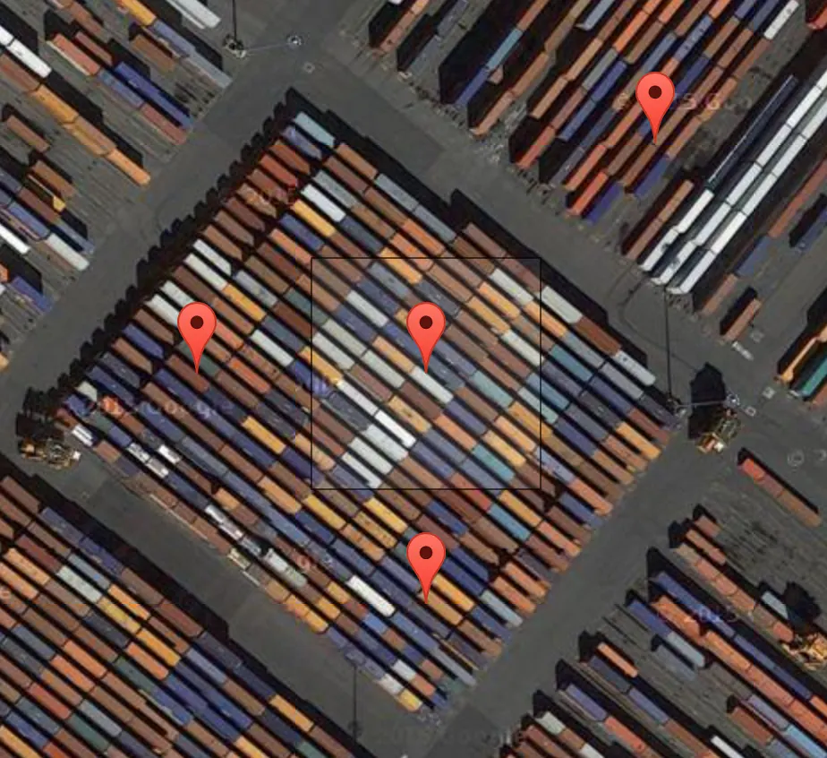 Terrapattern▲77
A visual search tool for satellite imagery
2016 · terrapattern.com · its alternatives →
- 12

Flexible tool to build planet-scale vector tilesets from OpenStreetMap data fast - onthegomap/planetiler
2021 · github.com · its alternatives →
- 13

- 14

:satellite: Simple and ready-to-use tutorials for TensorFlow - GitHub - instillai/TensorFlow-Course: :satellite: Simple and ready-to-use tutorials for TensorFlow
2018 · github.com · its alternatives →
- 15

Find the perfect image datasets for your next ML project
2020 · its alternatives →
- 16

With the OpenDataDiscovery Platform, you can collect metadata from any data source, regardless of format or location. This powerful platform provides data discovery, observability, and trust for your entire data pipeline.
2022 · opendatadiscovery.org · its alternatives →
- 17

Google released an API in May to get fetch 3D Tiles of anywhere on Earth. Using this in standard 3D engines like Blender is tricky because (1) the tiles are in a geographic coordinate system (2) you get a lot of little tiles at varying quality levels I wanted to simplify this so all you need to do is get an API key, select a map region and a zoom level, and get one combined glTF file that you can throw into any engine. Especially if you're just prototyping and want to see how this data looks in your engine before investing in figuring out all the nuances of the API & coordinate system. (Note…
2023 · github.com · its alternatives →
- 18

SkyLens is a live satellite tracker and declassified UAP evidence hub. Real-time 3D map of thousands of orbiting satellites, 375 UAP case files from official government releases, NASA asteroid approaches, and daily space news. Free, no signup.
Aug 2026 · skylens.yantraai.app · its alternatives →
- 19

Medium-low resolution satellite image platform
2025 · gisstar.online · its alternatives →
- 20

Hello folks, We are launching OpenObserve. An open source Elasticsearch/Splunk/Datadog alternative written in rust and vue that is super easy to get started with and has 140x lower storage cost compared to elasticsearch. It offers logs, metrics, traces, dashboards, alerts, functions (run aws lambda like functions during ingestion and query to enrich, redact, transform, normalize and whatever else you want to do. Think redacting email IDs from logs, adding geolocation based on IP address, etc). You can do all of this from the UI, no messing up with configuration files. OpenObserve…
2023 · github.com · its alternatives →
- 21

This is a service I've built to provide equirectangular cloud maps of the whole Earth, updated every 3 hours, for free. It's based on infrared and visible light data from EUMETSAT, processed to enhance the clouds and try to reduce the impact of surface temperatures on the final image. I built it because it's surprisingly hard to find these kinds of images in a format that's useful to developers and hobbyists. I was building a 3D ISS tracker and wanted to include live clouds but couldn't find anything good, so I got sidetracked, and here we are.
2023 · github.com · its alternatives →
- 22
 Skylive▲120
Never miss a celestial event, anywhere on Earth
Jun 2026 · skylive.world · its alternatives →
- 23
- 24

We’re excited to release the first preview of Stargate, an open source API framework for data. This project came about because we got tired of using different databases and different APIs depending on the work that we were trying to get done. With “read the manual” fatigue and lengthy selection proc
2020 · stargate.io · its alternatives →

Also compare
Ranked by how close each launch is in meaning, then by votes. Prices were read from each product’s own site when checked and can change. Refine with your own description →