Life & fun · alternatives · 2026

24 alternatives to Tokyo Trains
Semi inspired by the 3d Shinjuku station that was posted again recently, I noticed it was missing a large portion of the "complex" where "complex" is defined loosly has how far you can walk without stepping outside. So I asked Claude to make a 3d map of all Tokyo Trains, no libraries, and let you zoom into stations, and the first version with both map and the Shinjuku complex was ready in about 3 hours. It spent another 7 or so in various nit picky things I asked for to get to the current version. I know these will only get better but I think the thing I find most interesting is no libraries…
Tokyo Trains is an interactive 3D map of Tokyo's train network built without external libraries. Users can zoom into individual stations and explore complex interchanges like Shinjuku, seeing the connected walkways and… Below are 24 products that do a similar job, ranked by how close each is in meaning and then by launch-day votes.
- 1
 Yamanote 3D▲138
Ride Tokyo’s Yamanote Line in a 3D world
Aug 2026 · yamanote-3d.com · its alternatives →
- 2

Hi HN, I’m a junior developer. I wanted to share a side project I’ve been working on. The national railway carrier (BDZ) has no public API. They have an official map but the UI is quite dated, often lags, and doesn't show the full route context. I wrote a short write-up about the process here: https://www.pavlinbg.com/posts/bg-train-tracker I know it's still rough around the edges (I'm still working on it), but I’d love to hear your feedback or suggestions!
Dec 2025 · bdzmap.com · its alternatives →
- 3

deck.gl based visualiser of the TFL Api + National Rails to be able to track (with minimal drift) a train along the way in London and to the nearest airports. If you pick one from any platform in https://nexttrain.london basically you can share your train journey along the rails. Build to test Cloudflare workers and their infra along with deck.gl performance that is incredible in my opinion.
Jul 2026 · ride.nexttrain.london · its alternatives →
- 4

After visiting Japan for the first time a decade ago I became completely enamoured with Tokyo's Yamanote Line railway loop. Particularly the sonic experience of it. Like so many others I fell in love with the charming departure melodies and enjoyed discovering experiences like Yamanot.es (https://news.ycombinator.com/item?id=45045307) here on Hacker News when I returned home. But it wasn't until my second trip to Tokyo that I truly appreciated how much the door chimes, on-board announcements and train noise were contributing to the rich soundscape that I loved. I returned home…
Jul 2026 · yamanote.fun · its alternatives →
- 5

Explore the Berlin subway system using Memgraph Lab, mapping subway stops as nodes and connections as edges in a graph database.
2023 · memgraph.com · its alternatives →
- 6NS
Hello HN! As a long term NYC resident, I have read countless articles on ideas tweaking subway services, but always found them hard to follow without visual aid. So over the long weekend I decided to build one. It has all the basic features: trains would spawn at their origin, stop at stations, and slow down if it gets too close to another. You can also design custom routes by piecing tracks together. Have fun, and let me know what you think!
2025 · buildmytransit.nyc · its alternatives →
- 7

Hey all! My train the other day was delayed and I got curious where they all were at any given time, so I built a map and figured I'd share it.
2023 · trains.fyi · its alternatives →
- 8

Animated live map of the Berlin city trains
2022 · xn--ubhnchen-1za.vercel.app · its alternatives →
- 9MO
Hey Everybody! Hope you had a merry christmas Today I had a bit of fun with Claude. Started by scraping YC's startups list, then ran them through OpenAI's embedding service, then UMAP'd the embedding to reduce the dimension to just two coordinates and then just forced Claude to write React that would compile to visualize that. I had fun and I think it's interesting, so take a look! Also note that you won't be able to zoom on mobile (found about this Plotly limitation way too late). If there's interest I can fix this issue by changing plotting libs tomorrow :) Merry christmas
2024 · yc-map.vercel.app · its alternatives →
- 10

I've spent about a year building this game which is inspired by the BBC show "Race across the World". For those that don't know you have to race from point A to point B only using public transport and without flying. You have starting money but if you need to top up your funds you can work jobs. Any feedback is greatly recieved.
Feb 2026 · geo-racers.com · its alternatives →
- 11PF
Hey HN! A long time ago I built a map of trains at trains.fyi, and then realized nobody had bought planes.fyi - so this is my new map project. It's a bunch of things, but mostly, a 3D map of aircraft around given airports, as well as the weather, ATIS, and other data sources visualized in 3D and unique ways. Like most of the stuff I build, it's got no real use, but I think it's neat. If you like planes, check out the CYYZ/KJFK map, weather, and runway tabs - I put the most work into that. Also any feature requests, questions, comments, etc are always appreciated!
Dec 2025 · planes.fyi · its alternatives →
- 12

An interactive 3D visualization of the all the buildings in Manhattan.
2018 · tbaldw.in · its alternatives →
- 13
 MapScroll▲109
Hi HN, I built this after getting frustrated trying to map out things like “Ancient mayan ruins” or “James Bond movie locations” on Google "My" Maps. You basically have to drop pins manually, hunt down photos, copy links, it’s slow and never feels like an actual story. With MapScroll, you just type something like “Marco Polo’s route” or “forgotten WWII sites in France”, and it geocodes, grabs images + articles, and plots everything into a shareable story map. Each marker comes with a little gallery and sources tied to your prompt. You can also refine the first draft which AI creates before…
2025 · mapscroll.ai · its alternatives →
- 14

This was something I built while trying to look for housing in Toronto that was decently transit-accessible to my office while still cheap. The backend is written in Rust. It parses public GTFS data from transit agencies and performs a simple heuristics-based BFS on the bus lines to calculate how long to reach all points in a city. The frontend uses React and Mapbox GL to render each individual road segment based on how long it takes to reach. This project was a great excuse to learn Rust, deployments, and mapping. The source code is here if you are interested:…
2023 · map.henryn.xyz · its alternatives →
- 15

Many JS libraries exist to build graphs on the web (Vega, chartJS, Plotly...). They allow to make charts quickly. But you lose flexibility: you're limited by the options they offer. I just created a gallery with hundreds of graphs made with d3.js and React. - Examples are split by graph types - They all come with explanation and code sandboxes - Gradual complexity to ease the learning curve It took me ages to create this project! Feedback welcome!
2023 · react-graph-gallery.com · its alternatives →
- 16

- 17IM
Technologies used: Leaflet (frontend) Turf (Geojson generation and Voronoi generation) I noticed that my neighborhood is all Lawsons, so I got the location of all Conbinis and ran some basic analysis to see if these pockets of brand territory are common. I haven't worked much with web frontends before, so feedback is welcomed. I also have some ideas to maybe expand upon, like making the territory calculations based on streets and other geographical features rather than just beeline distance. The site isn't tested too much on mobile yet, but should be ok. Currently the frontend code and…
2024 · conbini.kikkia.dev · its alternatives →
- 18
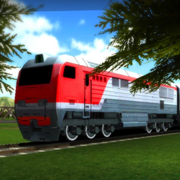 Train Ride 3D ▲65
Dedicate to all railfans. Control the train and enjoy!
2016 · teengames.mobi · its alternatives →
- 19

Stop staring at walls. Get the Mt. Fuji seat.
Nov 2025 · fujiseat.com · its alternatives →
- 20

Hello, I was running around Germany, hectically navigating public transportation, and getting lost all the time. I noticed that every station had i platforms, each used lists of n buses (trains, whatever) arriving, each has their list of m destinations. That means I would be scanning i x n x m items just to see if I was at the correct stop. As I was nervous, for every bus that arrived, I would rescan the list of stops to double check. I began thinking how I could make a better system. Linked is a very shoddy mockup of how bloom filters could be used to allow passengers O(1) lookup time for…
2023 · github.com · its alternatives →
- 21

Each moving arrow represents one real bike ride out of 291 million, and if you've ever taken a Citi Bike before, you are included in this massive visualization! You can search for your ride using Cmd + K and your Citi Bike receipt, which should give you the time of your ride and start/end station. Everything is open source: https://github.com/freemanjiang/bikemap Some technical details: - No backend! Processed data is stored in parquet files on a Cloudflare CDN, and queried directly by DuckDB WASM - deck.gl w/ Mapbox for GPU-accelerated rendering of thousands of…
Jan 2026 · bikemap.nyc · its alternatives →
- 22IM
Hi HN, I made SmartMap — a tool where you ask an open-ended question on maps, like: - "Where can I find coworking cafes with power sockets and Wi-Fi in Shibuya, Tokyo?" - "Places that inspired Studio Ghibli movies in Japan" You can also ask it to plot interactive journeys, like: - "Places Alexandra David-Néel visited on her way to Lhasa" - "Train stops along the original Orient Express route" It returns a live, interactive map with the results plotted as pins. Originally built this to scratch my own itch while traveling and researching or learning about new places. SmartMap makes that step…
2025 · smartmap.space · its alternatives →
- 23MA
Hello HN! I’m excited to share this open-source community mashup showing the power and possibility of combining 3D Gaussian splat scans with traditional mesh-based 3D tiles maps in the browser. As you've probably seen on HN a bunch lately, Gaussian splats are a new method to allow custom 3D scans of scenes and objects [1] and Google Maps 3D Tiles API are the same 3D buildings and street views your familiar with in Google Earth or Google Maps, and recently they’ve been made available for inclusion in web apps. Combining splats + 3d map mixes highly detailed real-world custom micro-scans with…
2024 · maps-and-splats.glitch.me · its alternatives →
- 24

During a recent subway outage in San Francisco I decided to build a webapp in the spirit of "Do I Need an Umbrella," basically to answer the question "Should I take the subway or a bus?" In the interest of learning new tools I decided to vibe code it as much as possible. First, I had Claude Code write a background script to download images of the real-time circuit diagram of the subway, which are publicly available here: http://sfmunicentral.com/ Next I had it build an image labeler tool in tkinter, which turned out to need a lot of manual tweaking before I could even get to…
Jan 2026 · munimet.ro · its alternatives →
Also compare
- Yamanote 3D alternatives
- The Official National Train Map Sucked, So I Made My Own alternatives
- Follow London Trains in 3D alternatives
- Yamanote.fun – A complete soundscape for Tokyo's Yamanote line alternatives
- Modeling Berlin subway lines in graph database alternatives
- NYC Subway Simulator and Route Designer alternatives
Ranked by how close each launch is in meaning, then by votes. Prices were read from each product’s own site when checked and can change. Refine with your own description →