Life & fun · alternatives · 2026

24 alternatives to Today's cities on a globe of Earth's tectonic past and future
A rotatable Earth that drags today's countries and major cities through the Merdith 2021 plate reconstruction model, plus a simple future extrapolation. Continents keep their color families while the land follows plate motion from 1000 million years ago to 250 million years ahead.
This interactive globe visualizes Earth's tectonic history and future by rotating today's countries and cities through 1 billion years of plate motion using the Merdith 2021 reconstruction model. Users can explore… Below are 24 products that do a similar job, ranked by how close each is in meaning and then by launch-day votes. Prices are shown for the 1 we have checked on their own sites, 1 of them free or with a free tier.
- 1

Earth looked very different long ago. Search for addresses across 750 million years of Earth
2018 · dinosaurpictures.org · its alternatives →
- 2
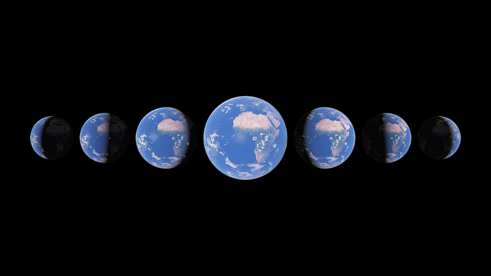
Watch time unfold and witness 40 years of planetary change
2021 · earth.google.com · its alternatives →
- 3
 Globe of History▲189
I built Globe of History — an interactive 3D visualization of 6,000 years of human events, mapped onto the Earth’s surface. It includes 5,000+ data points covering wars, inventions, assassinations, natural disasters, and philosophers — spanning 4000 BCE → 2025 CE. The main goal was to build a visual entry point into history — not a database, but a way to instantly sense density and continuity over time. Stack / Process Python for scraping structured event data from Wikipedia/Wikidata Gemini 2.0 Flash for AI-based enrichment and multi-stage verification Mapbox GL JS + React (Vite)…
Nov 2025 · globeofhistory.com · its alternatives →
- 4

I've been working on this project for about 4 years. It began as terrain only because world wide elevation data was publicly available. I then added buildings from OpenStreetMap (crowd sourced) and more recently from Overture Maps data. Some computer vision/machine learning advancements [1] in the past few years have made it possible to estimate tree canopy heights using satellite imagery alone making it possible to finally add trees to the map. The data isn't perfect, but it's within +/- 3 meters of so. Good enough to give a general idea for any location on Earth. Happy to answer…
2024 · shademap.app · its alternatives →
- 5
 Phersu Atlas▲68
Interactive historical atlas - daily data and 4M statistics
2023 · phersu-atlas.com · its alternatives →
- 6
 Portt▲118
Transform your photo into any era and any location
Apr 2026 · portt.app · its alternatives →
- 74Y
Apr 2026 · ssta.willhelps.org · its alternatives →
- 8

It's free to play on steam, but you'll need a computer with a dedicated graphics card. I just released a new version after first releasing it 18 months ago. It's been a hard slog to scrounge time as it's not my day job but that's life. There's a ton of obvious improvements in the future (weather systems, temperature, varying rainfall, ice/snow, more biomes, more plate tectonics, lava, etc) but all suggestions/feedback is welcome.
2023 · store.steampowered.com · its alternatives →
- 9

Features include: - Several preset periodic orbits: the classic Figure-8, plus newly discovered 3D solutions from Li and Liao's recent database of 10,000+ orbits (https://arxiv.org/html/2508.08568v1) - Full 3D camera controls (rotate/pan/zoom) with body-following mode - Force and velocity vector visualization - Timeline scrubbing to explore the full orbital period The 3D presets are particularly interesting. Try "O₂(1.2)" or "Piano O₆(0.6)" from the Load Presets menu to see configurations where bodies weave in and out of the orbital plane. Most browser…
Nov 2025 · trisolarchaos.com · its alternatives →
- 10
 AstraPixelsfree tier, from $5/mo▲267
A pixel-art solar system at its real current positions.
Aug 2026 · astrapixels.com · its alternatives →
- 11WP
2012 · boydgreenfield.com · its alternatives →
- 12
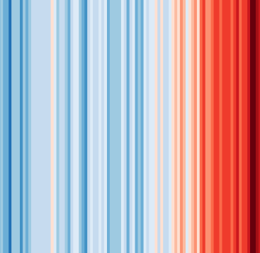 #ShowYourStripes▲140
Visualize 100+ years of climate change where you live ❄️🌎🔥
2019 · showyourstripes.info · its alternatives →
- 13

- 14LW
Hi HN, I made a web game to practice country locations a while ago and HN liked it, so I thought I'd post my updated version as well. As for how the game works and feels, I'd really recommend you checking it out for yourself, it's free, no signup, no ads. The tech stack is Vue + ts + Tailwind/Daisy for the looks. The learning algorithm is a slight modification of the ts version of FSRS. If you have anything to add, it's open source as well (https://github.com/koljapluemer/learn-worldmap), although not well documented yet. In the end it's just a little sideproject,…
2025 · map.koljapluemer.com · its alternatives →
- 15

OP here: I created this visualization tool as the byproduct of a supply chain class I taught at Columbia. The pedagogical exercise grew into a full blown visualization and paper about global oil trade. The model: The mechanics are the same as the financial network Eisenberg-Noe: Instead of banks, every country consumes oil interconnected via bilateral trading. Shocks propagate throughout the network, depleting oil reserves when bottleneck nodes (such as the Strait of Hormuz) are blocked. Insights: The interesting part is the mechanics of how the crisis unfolds: for example, France receives 0…
Jul 2026 · globaloilnetwork.staffinganalytics.io · its alternatives →
- 16

Google released an API in May to get fetch 3D Tiles of anywhere on Earth. Using this in standard 3D engines like Blender is tricky because (1) the tiles are in a geographic coordinate system (2) you get a lot of little tiles at varying quality levels I wanted to simplify this so all you need to do is get an API key, select a map region and a zoom level, and get one combined glTF file that you can throw into any engine. Especially if you're just prototyping and want to see how this data looks in your engine before investing in figuring out all the nuances of the API & coordinate system. (Note…
2023 · github.com · its alternatives →
- 17
 Globe 3D▲151
Convert your design into an interactive 3D globe
2021 · globe-3d.vercel.app · its alternatives →
- 18

A fork of Solar System Live that generates animated videos showing planetary orbits over any date range. Tracks orbital statistics (how many times Earth was lapped by Mercury/Venus, or lapped outer planets) and overlays dates/ages on each frame. Example: Einstein's lifetime (1879-1955) showing 76 years of solar system evolution. Built with Python + Pillow + ffmpeg, runs locally with Lighttpd. https://github.com/simondorfman/solar_system_live
Jan 2026 · github.com · its alternatives →
- 19TM
An interactive playground to explore the extreme distortions of the Mercator projection. Set any point on Earth as the new North Pole. Warp the map in real-time. See the world in a whole new way.
2014 · mrgris.com · its alternatives →
- 20

Mapping the future of human civilisations from Asia to US
2016 · blcw.me · its alternatives →
- 21IE
2017 · mjmdavis.com · its alternatives →
- 22G3
I made a web app to generate 3D models of real places on earth from land cover and elevation data. Click anywhere on the map to get a polygon, and then click "generate". It should work at most scales, but if your watershed or region selection is too large, the result can be less exciting because it's so flat. As a warning, the 3D models can sometimes be too much for my phone. It's nicer on desktop. I'm still working better on mobile support. The land cover data I'm using gives a cool effect, but at some point I'd like to add in global imagery and clouds. The backend is a Python thread…
2025 · topography.jessekv.com · its alternatives →
- 23AW
Global Temperature Change WebGL</i> is an experiment that tries to illustrate how global temperatures on earth have changed between 1850 and 2016.
2016 · callumprentice.github.io · its alternatives →
- 24
A Guide to the Extreme Present (Book)
2015 · amazon.com · its alternatives →
Also compare
Ranked by how close each launch is in meaning, then by votes. Prices were read from each product’s own site when checked and can change. Refine with your own description →